Digital Elevation Models
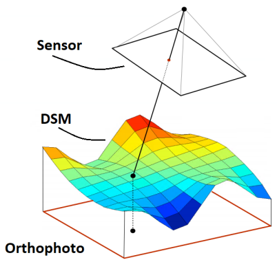
Digital elevation models are surface models depicting the areas topographic relief. These models are generated based on a point cloud derived from imagery collected over the project site. Noros generate various elevation models based on requirements:
Digital Surface Models (DSM)
These models are a pure surface model where all topography is included. This can be vegetation, constructions etc.
Digital Terrain Models (DTM)
Terrain models are surface models where vegetation and constructions are classified and later removed. This leaves a model where only the terrain is taken into account. This is typically used for volumetric calculations such as estimations of how much gravel is left in a gravel pit.

